Hydropower is the single most efficient form of electricity production and currently supplies a fifth of global energy needs. It ranks amongst the cleanest sources of power with a low greenhouse gas emission intensity compared to other energy forms. For many countries hydropower remains the largest source of affordable renewable energy. The sector is particularly susceptible to the risks of climate change and natural disasters and a better understanding is needed to ensure sustainable, resilient, and cost-effective outcomes. This increased awareness is important given climate change is significantly affecting hydrologic variability and leading to increase in wildfires, extreme droughts and severe flooding.
Satsense Solutions uses cutting edge satellite remote sensing technology and geospatial analytics to provide a suite of services to efficiently monitor natural hazards, measure environmental parameters within the catchment area and assess sedimentation in order to maximize power generation and increase the life cycle of hydropower plants.
What are these services?
Catchment Hazard Monitoring
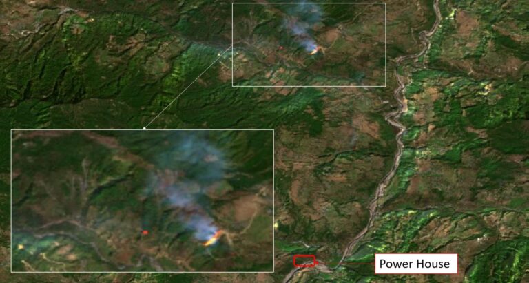
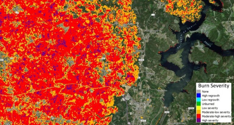
Environmental hazards, intensified by climate change, can impact the efficiency and lifespan of hydropower plants. Regular monitoring can detect occurrences of hazards such as wildfires, floods, landslides, etc. within the catchment area and help understand the risk they pose to the infrastructure and people in the region. Wildfires and landslides can increase sediment flows, while floods can increase surface runoff rates and cause severe damage to equipment and loss of lives. This solution uses satellite derived topography data to delineate precise catchment and sub-basins. Multispectral and radar data from space borne sensors are then used to monitor environmental hazards within the catchment area.
Sediment Assessment
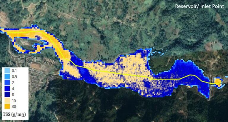
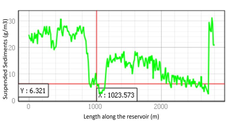
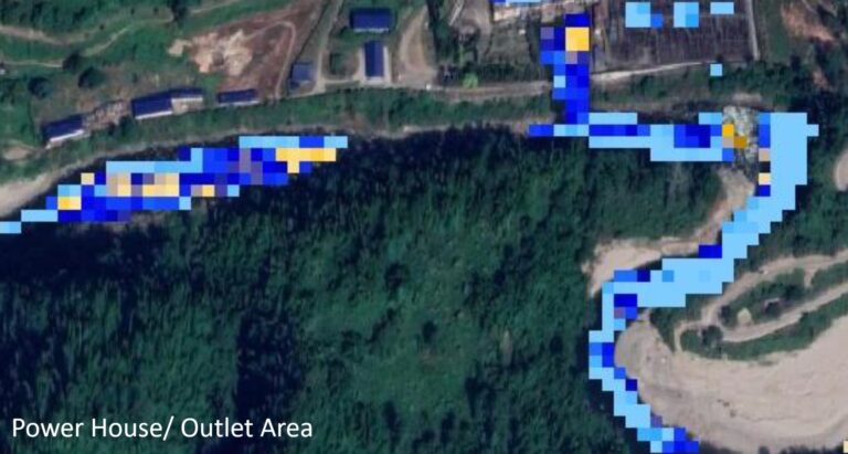
Sedimentation poses a serious threat to the longevity and operational efficiency of both, Storage and Run-of-River (or ROR) hydropower plants. Over time sediment builds up in reservoirs, leading to loss of reservoir storage, decrease in discharge capabilities and damage to turbines and other mechanical equipment. In addition, sedimentation can cause environmental damage due to sediment starvation (downstream) and excessive concentration (upstream). Thus, managing sedimentation is important to ensure power plants continue to operate at optimal power generation capacity and cause minimal environmental impact.
Conventional methods of evaluating sediment inflow pose challenges as sediment content varies considerably with flow rates and seasonal changes. Using satellite remote sensing solutions, we can better assess sedimentation and provide accurate, comprehensive and actionable insights thus enabling plant operators to take timely action. The solution can help identify high erosion areas within the catchment area, develop and validate sediment rating curves, determine trap efficiency and sediment yields and facilitate suitable sediment management practices.
Snowpack Assessment
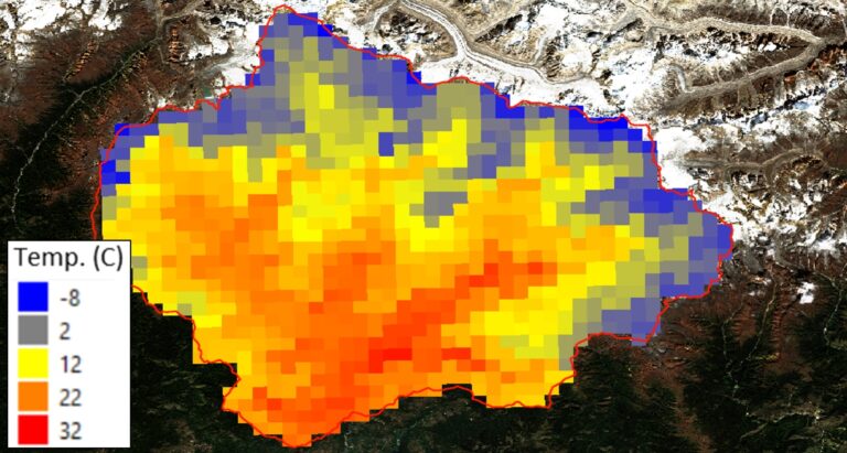
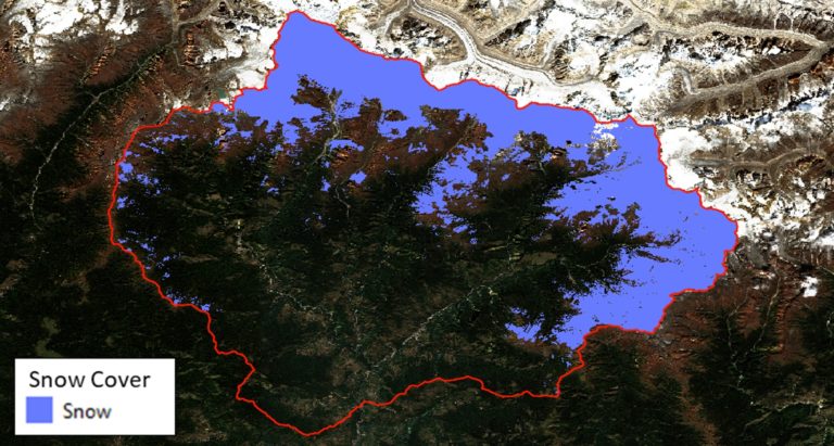
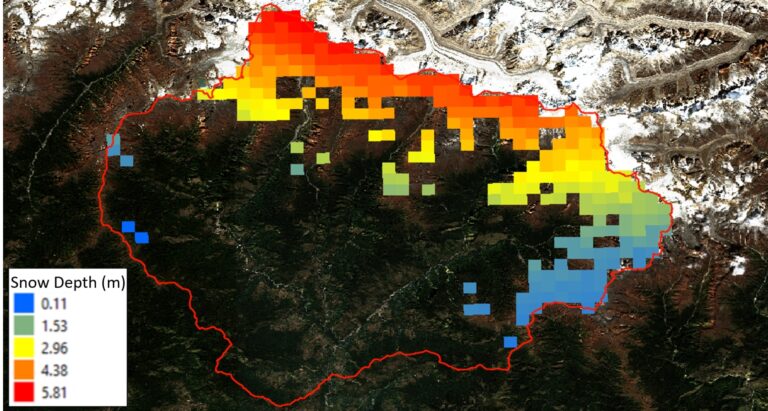
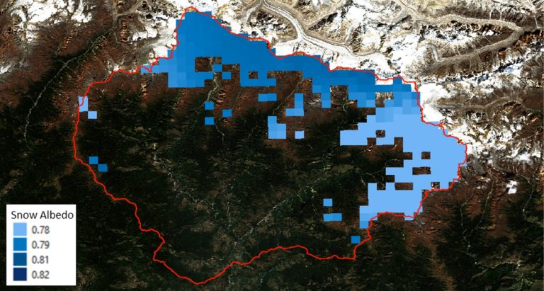
To manage hydroelectric plants and plan the production or storage of water and evaluate their impacts on the power market, it is important to know not only the rain, but also the water contained within the snowpack (snow water equivalent) in the catchment. The knowledge of snowpack and ice thickness is therefore a crucial aspect in forecasting annual inflow at turbine. Using satellite remote sensing solutions, we can measure snow-related environmental parameters, such as snow cover, snow depth, albedo and land surface temperatures, on a daily frequency. These measurements can be used for snow melt modelling and snow water equivalent calculations, to forecast annual water inflow rates. This enables energy producers to better manage the natural resources and make the renewable power production more efficient.
Contact Us
Disclaimer: Satellite remotely sensed data are generally recorded under changing environmental conditions, which might impact the accuracy of output data. Although results are based on well-established methods and tools are thoroughly validated for accuracy, remotely sensed data are subject to natural variations of the atmosphere, local conditions etc., therefore Satsense Solutions Limited cannot take any responsibility caused by the usage and interpretation of remote sensing products. As with all measuring tools / systems, calibration based on in-situ data is recommended.