
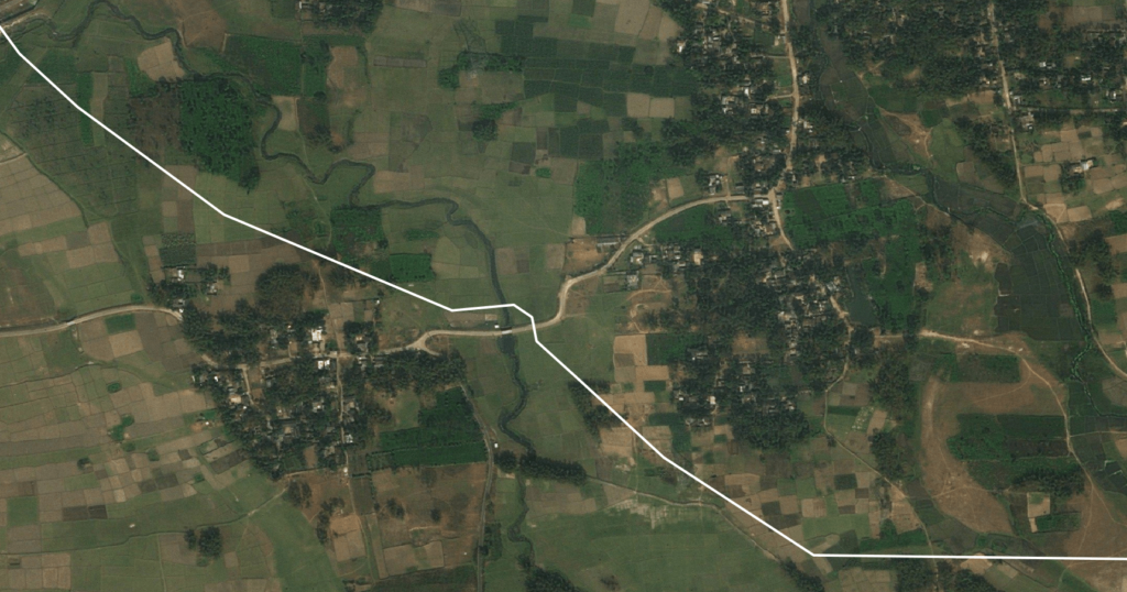
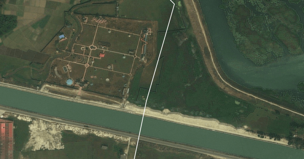
Route Selection Analyses
Optimal route selection is an integral step at the design and planning stage of infrastructure projects. Selecting the optimal route for pipelines, highways, railway lines, power transmission lines and irrigation canals not only increases the asset’s longevity, but also mitigates environmental risks and reduces operational costs during the asset’s life. Optimal routes can be determined based on topography, land use and weather patterns, also by avoiding geohazard prone and environmental sensitive areas and reducing social conflicts.
Who can use these services?
- Infrastructure Development Companies
- Pipeline Engineering and Construction Companies
- Power Utility Companies
- Railway and Highway Authorities
- Government and Policy Makers
Satsense Solutions Ltd. uses cutting-edge satellite remote sensing technology and geospatial analytics to determine the most optimal route for infrastructure projects. This is achieved by assessing the following parameters of potential routes:
- Land topography, slope and elevation
- Weather conditions and patterns over time
- Natural constraints such as water bodies, river crossings and fault lines
- Man-made constraints such as protected areas, residential clusters and major crossings
- Accessibility to roads, infrastructure projects and Special Economic Zones (SEZ)
- Land Use classification, in order to minimize social conflict or relocation
- Avoiding geohazard prone areas, mining concessions and defense establishments
Start and end points, along with intermediate connections of the route are specified by the client. Engineering, environmental, social and regulatory constraints along with user requirements are also gathered from the client and incorporated into the workflow. An algorithm using an iterative feedback loop is used to map possible routes. The results are then evaluated, potential routes short-listed and shared with the client. Feedback provided is used to adjust criteria and the algorithm in rerun until an optimal route is determined.
Outputs can be provided in the form of Alignment Sheets, Vector Shapefiles, GeoTIFFs or KMZs, that may be loaded into a CAD or GIS software. Detailed reports outlining the parameters and criteria may also be provided.
The Route Selection Analyses solution provides the following benefits:
- Cost and time savings: Large geographical areas can be surveyed efficiently and quickly, at a relatively lower cost.
- Convenient: Data from remote or difficult to reach areas can be easily incorporated into the algorithm and assessed, without having boots on the ground.
- Comprehensive: Engineering, environmental, social and regulatory factors can be explored together under one algorithm to determine the optimal route.
- Competitive advantage: Provides unique and valuable insights to better understand inherent risks, thereby allowing for better decision making at time of bidding.
- Conflict resolution: Conflicting and interactive criteria can be easily weighed and resolved
- Faster evaluation process: Using the iterative feedback loop, changes incorporated can be evaluated much faster and outcomes shared with stakeholders sooner.