Our planet faces an unprecedented demand for clean water caused by the cumulative impacts of population growth, increasing consumption, declining resources, pollution and climate change. With groundwater supplies dwindling and increasing demand for clean water, both for human and commercial activities, it has become critical to assess surface water resources to ensure a constant supply of clean water is maintained. Water managers today, more than before, need comprehensive and effective tools to meet these challenges.
Satsense Solutions uses cutting edge satellite remote sensing technology combined with Artificial Intelligence and geospatial analytics to provide a suite of services for water managers to better assess water resources.
What are these services?
Water Quality Assessment
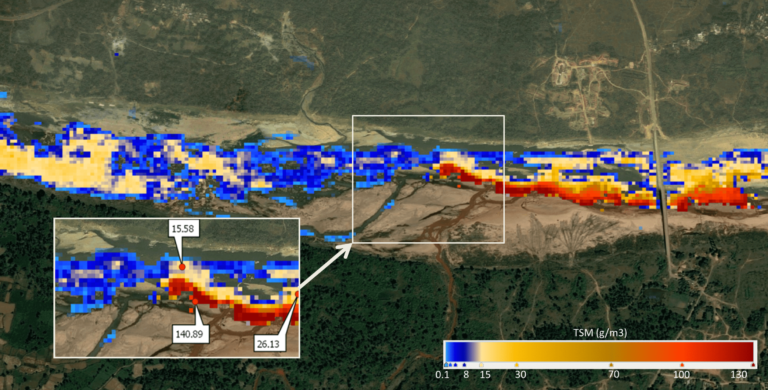
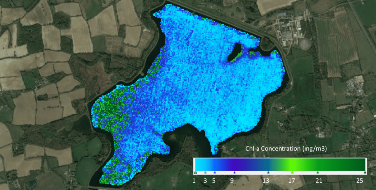
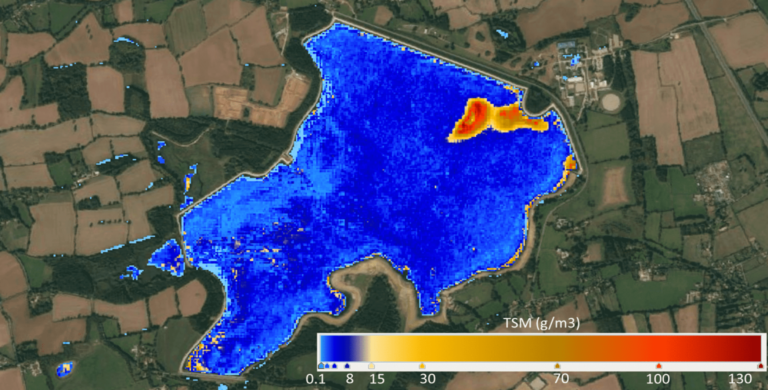
This solution assesses the water quality of inland water bodies such as lakes, reservoirs and rivers and coastal waters. The assessment is based on the water’s inherent optical properties observed from multispectral satellite data. The water quality parameters assessed are Total Suspended Solids (TSS), Chlorophyll-a (Chl-a), Coloured Dissolved Organic Matter (CDOM) and transparency or turbidity. These parameters provide a good understanding of the state of the water bodies under observation. For example, TSS indicates industrial effluence being discharged into the water, Chl-a shows algae-bloom, CDOM points to organic materials in the water and turbidity signifies the murkiness of the water.
Catchment Area Management
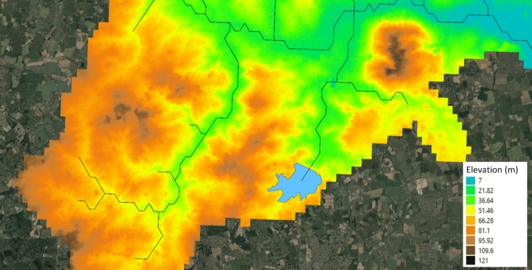
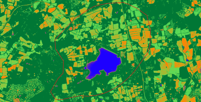
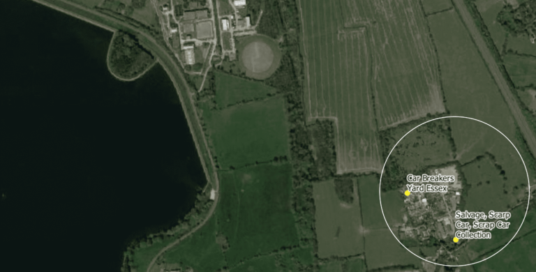
The maintenance of healthy catchment areas is fundamental to the supply of safe and reliable drinking water. This solution uses precise topography data from satellites to determine the flow direction of water within the catchment area. The catchment area is observed for land use and changes in land cover in order to identify potential risks and hazards based on flow directions and land use activities. Surface water quality can then be monitored to determine both point and diffuse sources of pollution and appropriate remediation actions recommended.
Contact Us
Disclaimer: Satellite remotely sensed data are generally recorded under changing environmental conditions, which might impact the accuracy of output data. Although results are based on well-established methods and tools are thoroughly validated for accuracy, remotely sensed data are subject to natural variations of the atmosphere, local conditions etc., therefore Satsense Solutions Limited cannot take any responsibility caused by the usage and interpretation of remote sensing products. As with all measuring tools / systems, calibration based on in-situ data is recommended.

