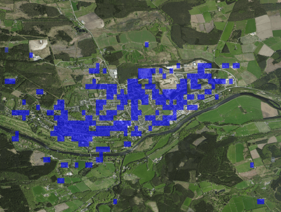
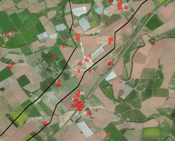
Ground Subsidence
Ground subsidence is the downward settling of the ground’s surface caused by natural events such as earthquakes, landslides or by human activities such as construction, sub-surface mining or extraction of underground fluids. Ground subsidence affects the stability and safety of buildings and infrastructure such as roads, bridges and pipelines and is therefore critical for engineers, surveyors, urban planners, infrastructure operators, landowners and insurance companies to measure and assess ground subsidence both at the construction planning stage as well as on a regular basis.
Key features of this service are as follows:
- Subsidence measured in mm, where positive values indicate uplift and negative values indicate subsidence of ground surface over a period of time
- Areas of low coherence are masked out to increase reliability
How are the services provided?
- Since the data are obtained through satellite remote sensing, ground subsidence can be detected without the need of surveyors and levelling instruments.
- The results can be provided in the form of raw data, Geo-TIFFs, KMZ files or detailed reports, as per requirement.
Satsense Solutions Ground Subsidence Detection Service provides a highly effective and reliable solution for measuring level of subsidence over a given area. The service provides the following benefits:
- Large geographic areas can be assessed remotely for ground movement, thereby allowing difficult to reach, dangerous or logistically too expensive to inspect areas to be covered
- Feasibility studies on ground movements for housing and infrastructure projects can be carried out without the need of onsite visits by surveyors or use of levelling instruments
- Regular monitoring of critical infrastructure can be achieved to assess safety and stability and act as an early warning indicator for any impending danger
- Impacts of natural calamities (ground level before / after) can be measured and assessed
Satsense Solutions Ground Subsidence detection services can be used by a variety of businesses and government agencies:
- Infrastructure companies to determine suitable construction sites and ongoing monitoring of structural stability of roads, bridges, dams, pipelines and other critical infrastructure projects
- Mining companies and regulators to monitor the effect of sub-surface mining
- Hydrocarbon Pipeline operators for monitoring safety and structural integrity of pipelines
- Ground water regulators to analyze the effects of groundwater extraction
- Municipal Corporations to check the stability of sewer lines, storm water drains and underground pipeline networks
- Home owners and home insurance companies to determine structural risks to property
- Insurance companies to analyze the impact of ground movements caused by natural disasters like earthquakes and landslides and human activities